Northumberland Walks Logo

Northumberland Walks Panorama.
Homepage * Site Map * Privacy * Terms * E-mail

© Copyright - All walk descriptions and photos on this website are subject to copyright.


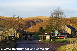
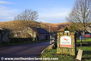
Northumberland-Walks.co.uk - photographic walks in Northumberland.


Alwinton - Clennell Street - River Alwin Valley Walk

Introduction

This walk starts in the car park at Alwinton in Upper Coquetdale. The route follows Clennell Street, (an ancient drove road) onto the hills and drops steeply down to the River Alwin Valley, returning along a forestry track via Clennell.

We did this walk on a mild day in January with some hazy sunshine at times. The walk provides great views over the river Coquet Valley and the Cheviot Hills.

Distance - Just over 5 miles.

Parking - Car park in Alwinton (£2 .00 when we visited).

Toilets - In car park (still open when we visited).

Clennell Street.
Clennell Street.

River Alwin near Kidland Forest.
River Alwin near Kidland Forest.

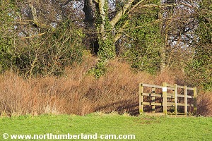
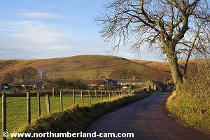
Walk

1) From the car park we turned left and walked through the village towards the green opposite the pub.

Straight ahead is a footbridge over the Hosedon Burn which we crossed and turned left onto the footpath to Clennell.

Car park at Alwinton.

View from the car park.


Footbridge over the Hosedon Burn.

Leaving Alwinton past the farm.


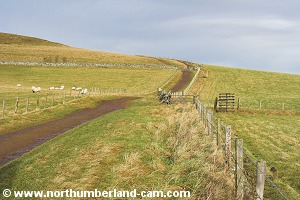
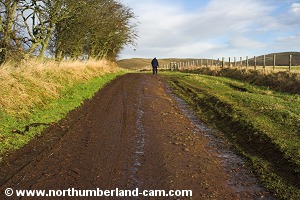
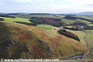
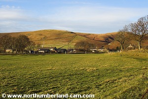
2) The path soon becomes a track passing a farm on the left. It was wet with water forming a stream down it when we visited.

Just past the farm there is a fine view along Upper Coquetdale on the left.

View to the ancient settlements.

View along Upper Coquetdale.


Heading up the track from Alwinton.

View to Clennell Hill and Silverton Hill.


View along Clennell Street.

View to the ancient settlements.


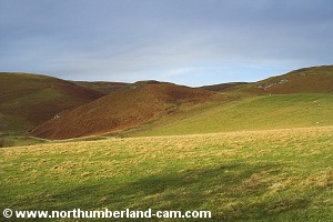
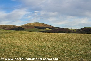
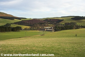
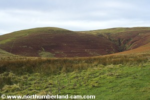
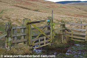
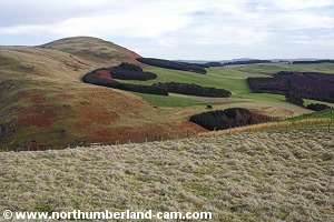
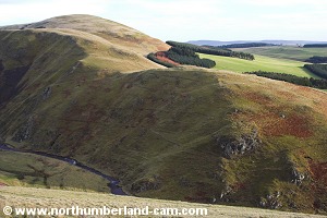
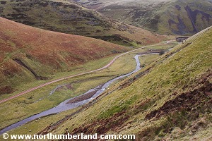
3) As we climbed higher along the track we reached a gate with a very high stile over the wall next to it.

After passing through the gate we paused to admire the view over the River Alwin Valley to Clennell and Silverton Hill beyond.

The gate and very high stile.

Looking back towards Alwinton.


View towards Clennell.

Closer view of Clennell.


View past Clennell to Silverton Hill.


View past Clennell to Silverton Hill.


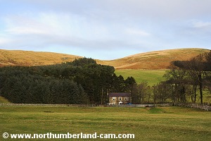
4) Climbing higher, the track passes an ancient settlement on the left and some cottages on the right where the gradient becomes gentler.

View to Lords Seat.
View to Lords Seat.

View along the track near the cottages.


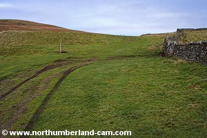
5) After the cottages Clennell Street carries on uphill, but we took a path to the right passing through a gate in the fence onto more level ground.

View back along the track near the cottages.

Path leading away from Clennell Street.


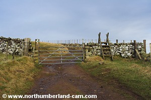
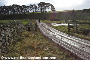
6) Soon we reached a small gate and stile which were almost impassible due to very deep mud. Fortunately we clambered across without getting stuck knee deep in the bog.

The stile and gate in a bog.

View across the River Alwin Valley.


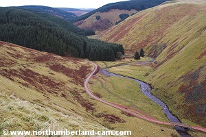
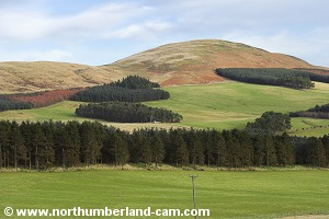
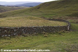
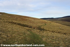
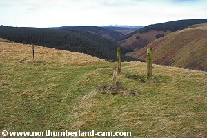
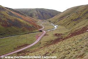
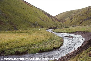
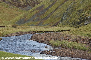
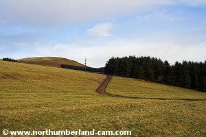
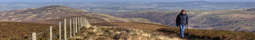
7) The path became level and fairly dry after the stile and leads along Cross Dyke, with fine views down into the valley with the River Alwin snaking it's way along to Clennell, crisscrossing by the track along which we would return.

Path along Cross Dyke.


Path along Cross Dyke.


View down into the valley.

View to Clennell Hill and Silverton Hill.


View down the valley to Clennell.


Path along Cross Dyke.


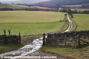
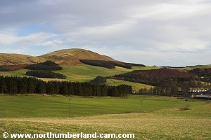
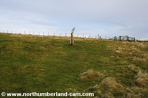
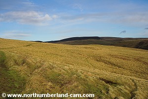
8) The path goes gently downhill before reaching the remains of an old gate with the view of Kidland Forest ahead and the valley down below.

Approaching the path down to the valley.

The old gate posts.
The old gate posts.


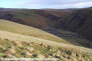
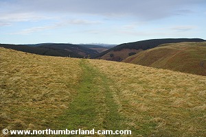
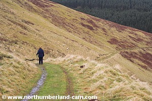
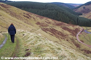
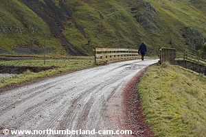
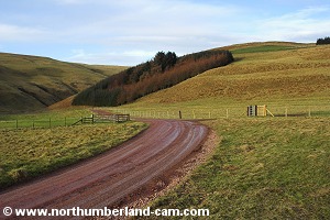
9) At this point the path starts to drop steeply into the valley towards the forest track, meeting just before the entrance to the forest.

Path down to the valley. Path down to the valley.

Path down to the valley.

   
View down to the forestry track and River Alwin.

Views down to the forestry track and River Alwin.

   
View back down the valley. View back down the valley.

Views back down the valley.

   
Approaching the track at the entrance to Kidland Forest. Approaching the track at the entrance to Kidland Forest.

Approaching the track at the entrance to Kidland Forest.


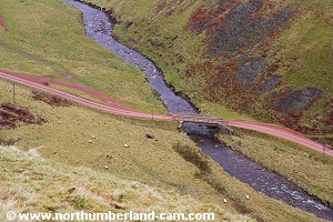
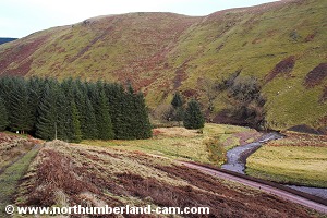
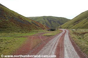
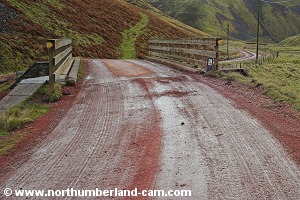
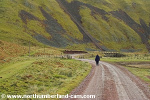
10) After crossing a stile we turned right onto the track to make our way back down the valley.

The track crosses back and forth over the River Alwin using wooden bridges on it's way to Clennell.

View along the track beside the River Alwin. View along the track beside the River Alwin.

Views along the track beside the River Alwin.


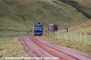
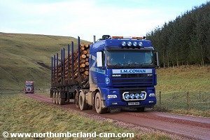
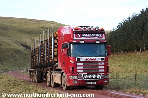
11) The track may seem quiet enough but very large trucks use it to haul timber from Kidland Forest, so you have to get well clear onto the grass or risk a good spraying with mud on a wet day.

View approaching Clennell.

Timber trucks approaching from behind.

   
Smart trucks - must take a lot of keeping clean! Smart trucks - must take a lot of keeping clean!

Smart trucks - must take a lot of keeping clean!


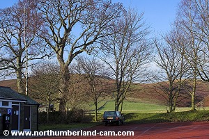
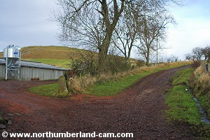
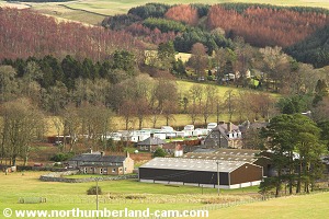
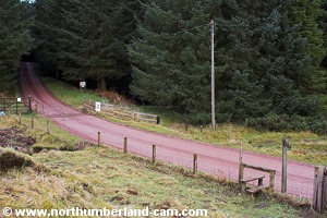
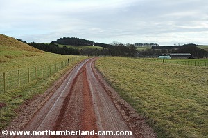
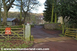
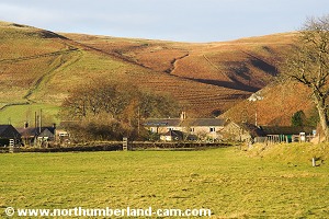
12) After awhile we reached Clennnell, passing the hall, farm and caravan site on the left. At this point the track becomes a tarmac road still alongside the River Alwin.

View to Silverton Hill, near Clennell.

View back along the track.


View at Clennell.
View at Clennell.

The track at clennell.


Entrance to Clennell Hall.

Tarmac Road after Clennell.


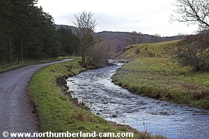
13) Soon after crossing the river again we reached the main road and turned right towards Alwinton.

On the left is the show field where Alwinton Show is held in the Autumn. It is usually the last county show of the year in Northumberland.

View of Alwinton and Lords Seat. View of Alwinton and Lords Seat.

View of Alwinton and Lords Seat.


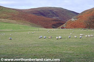
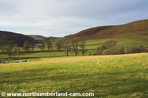
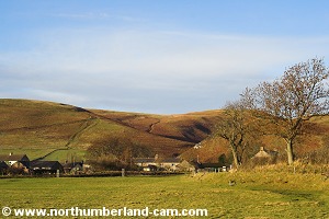
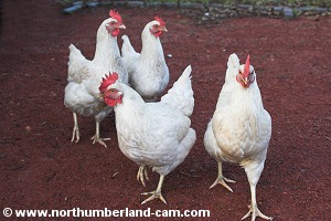
14) Ahead is a good view of Alwinton with Lord's Seat in the background.

From here we followed the road back through the village to the car park where marauding hens were once again looking for food from walkers!

Back in Alwinton Village. Back in Alwinton Village.

Back in Alwinton Village.

   
Alwinton Car Park. Hens looking for food in the car park.

Back in Alwinton car park and the hens looking for food.


Notes

Walking Gear:

- Strong, waterproof hill-walking boots essential.

- Waterproof clothing advised.

- Food and drink advised.

- Walking poles helpful.

Maps - Ordnance Survey Landranger sheet no. 80 - Cheviot Hills and Kielder Forest.

Use of information on this page is at the users risk and subject to our terms of use. (No reproduction without permission).


To see larger photos please visit
Northumberland Cam


Northumberland Walks Logo

© Copyright - All walk descriptions and photos on this website are subject to copyright and may not be reproduced in any format without prior permission.


If you would like to use any walking article or photo please use our E-mail form to make your request.

Northumberland-Walks.co.uk ©
Homepage * Site Map * Privacy * Terms * E-mail

Link opens new browser window.

Link opens new browser window.